-
Escolha o idioma do site
-
 Deutsch
DE
Deutsch
DE
-
 English
EN
English
EN
-
 Français
FR
Français
FR
-
 Español
ES
Español
ES
-
 Italiano
IT
Italiano
IT
-
 Polski
PL
Polski
PL
-
 Português
PT
Português
PT
-
País para onde enviar

-
Escolha o idioma do site
-
Deutsch
DE
-
English
EN
-
Français
FR
-
Español
ES
-
Italiano
IT
-
Polski
PL
-
Português
PT
-
País para onde enviar
-
Escolha o idioma do site
-
Deutsch
DE
-
English
EN
-
Français
FR
-
Español
ES
-
Italiano
IT
-
Polski
PL
-
Português
PT
-
País para onde enviar
-
Cardápio

-
Classificações

-
Jogo de tabuleiro

-
RPG

-
Party

-
CG

-
Acessórios

-
Lego

-
Livro

-
Quadrinhos


Editora: Historic One
Cry Havoc Map The Fortified Village

uplay.it Preço
Preço de varejo
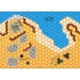
Editora: Historic One
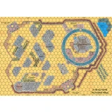
Cry Havoc Map The Welsh Castle
Mapa mostrando um castelo com a arquitetura típica das fortalezas que o rei Eduardo I da Inglaterra construiu no início do século XIV para controlar o...
Editora: Historic One
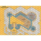
Cry Havoc Map The Fortified Village
Double map representing a circular castle and its village defended by a wooden palisade. The plan is inspired by the castle of Avalon in the Daup...
Editora: Historic One
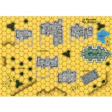
Cry Havoc Map The Hamlet
Map representing a village grouped around its church. The map meets the Cry Havoc standard, is printed in high definition (300 dpi) and on a strong...
Editora: Historic One
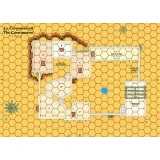
Cry Havoc Map The Caravanserai
The map displays a courtyard surrounded by stables and an inn. A covered passage provides access to a small medina located higher up. The map meets...
Editora: Historic One
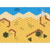
Cry Havoc Map The Beach
Mapa mostrando uma costa com uma praia protegida por diques. O mapa atende ao padrão Cry Havoc, é impresso em alta definição (300 dpi) e em um papelão...
Editora: Historic One
Cry Havoc Map The Cove
Map showing a coast with a cove dominated by a watchtower and some dwellings. The map meets the Cry Havoc standard, is printed in high definition...
Editora: Historic One
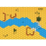
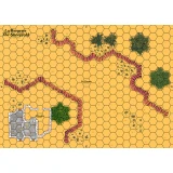
Cry Havoc Map The River
Map showing flat land cut through by a river that crosses at a ford. The map meets the Cry Havoc standard, is printed in high definition (300 dpi)...
Editora: Historic One
Cry Havoc Map The Islet
Map of an ocean with a small island. The map meets the Cry Havoc standard, is printed in high definition (300 dpi) and on a strong varnished cardb...
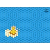
Editora: Historic One
Cry Havoc Map The Sheephold
Map representing a small pass guarded by a sheepfold. The map meets the Cry Havoc standard, is printed in high definition (300 dpi) and on a stron...
Editora: Historic One
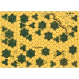
Cry Havoc Map The Woods
Map depicting a small forest. The map meets the Cry Havoc standard, is printed in high definition (300 dpi) and on a strong varnished cardboard si...
Editora: Historic One
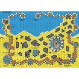
Cry Havoc Map The Saxon Harbour
O PORTO FORTIFICADO é composto por 4 mapas projetados por Jean-Michel Clément. O porto em si ocupa 2 mapas, com seu armazém e seu cais, e está fechado...
Editora: Historic One
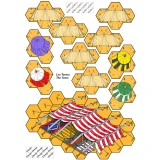
Cry Havoc Overlay The Tents
Overlays printed on A4 heavy paper featuring several tents and a larger one used by emirs. A component of the AGER SANGUINIS boxed set.